


Nevache Aiguille Rouge moi

c.gourme
User
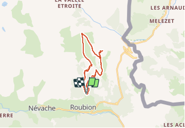

Length
12.1 km

Max alt
2514 m

Uphill gradient
822 m
Km-Effort
23 km

Min alt
1681 m

Downhill gradient
829 m
Boucle
Yes
Creation date :
2021-10-28 06:50:37.0
Updated on :
2021-10-28 13:28:02.91
5h21
Difficulty : Medium

FREE GPS app for hiking
 SityTrail
IGN / Geographical institutes
SityTrail Plus
The world is yours!
About
Trail Walking of 12.1 km to be discovered at Provence-Alpes-Côte d'Azur, Hautes-Alpes, Névache. This trail is proposed by c.gourme.
Positioning
Country:
France
Region :
Provence-Alpes-Côte d'Azur
Department/Province :
Hautes-Alpes
Municipality :
Névache
Location:
Unknown
Start:(Dec)
Start:(UTM)
313600 ; 4988523 (32T) N.
Comments