


aubussargues brun

Dan30
User
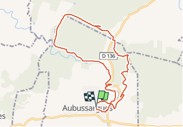

Length
10.8 km

Max alt
199 m

Uphill gradient
170 m
Km-Effort
13.1 km

Min alt
98 m

Downhill gradient
174 m
Boucle
Yes
Creation date :
2021-10-28 11:51:47.69
Updated on :
2021-10-28 15:02:26.311
3h00
Difficulty : Easy

FREE GPS app for hiking
 SityTrail
IGN / Geographical institutes
SityTrail Plus
The world is yours!
About
Trail Walking of 10.8 km to be discovered at Occitania, Gard, Aubussargues. This trail is proposed by Dan30.
Positioning
Country:
France
Region :
Occitania
Department/Province :
Gard
Municipality :
Aubussargues
Location:
Unknown
Start:(Dec)
Start:(UTM)
606486 ; 4873567 (31T) N.
Comments