


VTT elancourt

affinetataille
User GUIDE
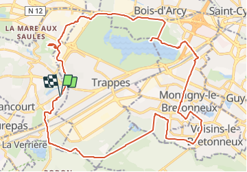

Length
26 km

Max alt
219 m

Uphill gradient
226 m
Km-Effort
29 km

Min alt
152 m

Downhill gradient
226 m
Boucle
Yes
Creation date :
2021-10-29 07:50:07.278
Updated on :
2021-10-30 13:07:39.683
2h01
Difficulty : Easy

FREE GPS app for hiking
 SityTrail
IGN / Geographical institutes
SityTrail Plus
The world is yours!
About
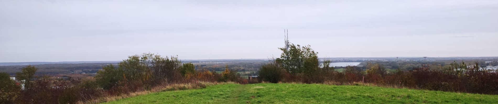
Trail Mountain bike of 26 km to be discovered at Ile-de-France, Yvelines, Élancourt. This trail is proposed by affinetataille.
Photos


Positioning
Country:
France
Region :
Ile-de-France
Department/Province :
Yvelines
Municipality :
Élancourt
Location:
Unknown
Start:(Dec)
Start:(UTM)
424591 ; 5402540 (31U) N.
Comments