


Vieux_Castillon,_Pic_Garuche-13885429-1635535143-936

Renefrt
User
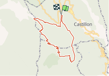

Length
9.2 km

Max alt
1188 m

Uphill gradient
520 m
Km-Effort
16.2 km

Min alt
703 m

Downhill gradient
526 m
Boucle
Yes
Creation date :
2021-10-29 19:19:13.0
Updated on :
2021-10-29 19:19:24.395

FREE GPS app for hiking
 SityTrail
IGN / Geographical institutes
SityTrail Plus
The world is yours!
About
Trail of 9.2 km to be discovered at Provence-Alpes-Côte d'Azur, Maritime Alps, Castillon. This trail is proposed by Renefrt.
Positioning
Country:
France
Region :
Provence-Alpes-Côte d'Azur
Department/Province :
Maritime Alps
Municipality :
Castillon
Location:
Unknown
Start:(Dec)
Start:(UTM)
376200 ; 4854904 (32T) N.
Comments