


Refuge de Route-Aulus les Bains

ARVIEU
User

Length
22 km

Max alt
1656 m

Uphill gradient
1562 m
Km-Effort
44 km

Min alt
730 m

Downhill gradient
1799 m
Boucle
No
Creation date :
2021-10-31 10:25:12.329
Updated on :
2021-10-31 10:26:11.236
9h00
Difficulty : Difficult

FREE GPS app for hiking
 SityTrail
IGN / Geographical institutes
SityTrail Plus
The world is yours!
About
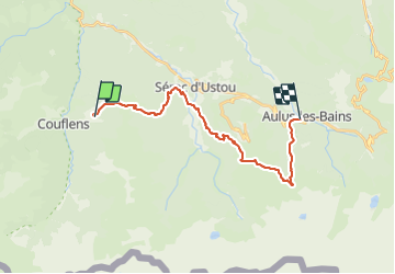
Trail Walking of 22 km to be discovered at Occitania, Ariège, Ustou. This trail is proposed by ARVIEU.
Positioning
Country:
France
Region :
Occitania
Department/Province :
Ariège
Municipality :
Ustou
Location:
Unknown
Start:(Dec)
Start:(UTM)
353284 ; 4739096 (31T) N.
Comments