


CRATERE DOLOMIEU - PITON DE LA FOURNAISE

jpb83
User
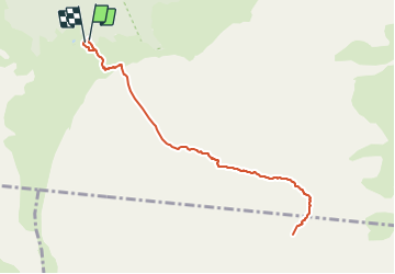

Length
12.7 km

Max alt
2490 m

Uphill gradient
550 m
Km-Effort
20 km

Min alt
2213 m

Downhill gradient
538 m
Boucle
Yes
Creation date :
2021-11-01 05:06:29.094
Updated on :
2021-11-01 05:06:31.345
4h32
Difficulty : Medium

FREE GPS app for hiking
 SityTrail
IGN / Geographical institutes
SityTrail Plus
The world is yours!
About
Trail Walking of 12.7 km to be discovered at Réunion, Unknown, Sainte-Rose. This trail is proposed by jpb83.
Positioning
Country:
France
Region :
Réunion
Department/Province :
Unknown
Municipality :
Sainte-Rose
Location:
Unknown
Start:(Dec)
Start:(UTM)
363708 ; 7653155 (40K) S.
Comments