


cavalaire, le dattier par les DFCI

francislassauce
User
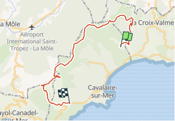

Length
14.7 km

Max alt
470 m

Uphill gradient
506 m
Km-Effort
21 km

Min alt
27 m

Downhill gradient
495 m
Boucle
No
Creation date :
2021-11-04 09:46:45.144
Updated on :
2021-11-04 12:11:18.271
1h51
Difficulty : Very easy

FREE GPS app for hiking
 SityTrail
IGN / Geographical institutes
SityTrail Plus
The world is yours!
About
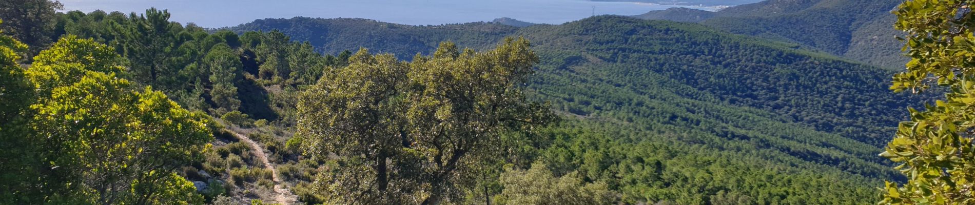
Trail Trail of 14.7 km to be discovered at Provence-Alpes-Côte d'Azur, Var, Cavalaire-sur-Mer. This trail is proposed by francislassauce.
Description
la montée dans les villas est dure d'entrée.
superbes vues quand on est au sommet
Photos


Positioning
Country:
France
Region :
Provence-Alpes-Côte d'Azur
Department/Province :
Var
Municipality :
Cavalaire-sur-Mer
Location:
Unknown
Start:(Dec)
Start:(UTM)
300513 ; 4785434 (32T) N.
Comments