


le cuit par les deux chapelles

bernir
User
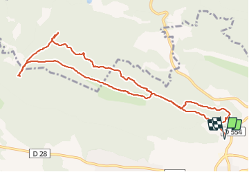

Length
12.3 km

Max alt
520 m

Uphill gradient
427 m
Km-Effort
18 km

Min alt
267 m

Downhill gradient
427 m
Boucle
Yes
Creation date :
2021-11-04 08:15:07.931
Updated on :
2021-11-05 06:41:47.646
6h50
Difficulty : Medium

FREE GPS app for hiking
 SityTrail
IGN / Geographical institutes
SityTrail Plus
The world is yours!
About
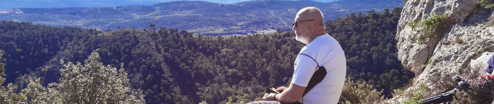
Trail Walking of 12.3 km to be discovered at Provence-Alpes-Côte d'Azur, Var, Le Val. This trail is proposed by bernir.
Photos

Positioning
Country:
France
Region :
Provence-Alpes-Côte d'Azur
Department/Province :
Var
Municipality :
Le Val
Location:
Unknown
Start:(Dec)
Start:(UTM)
263051 ; 4814537 (32T) N.
Comments