


La Cadière d'Azur-05-11-21

Christiancordin
User
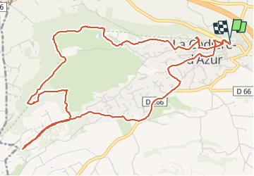

Length
7.9 km

Max alt
226 m

Uphill gradient
189 m
Km-Effort
10.4 km

Min alt
101 m

Downhill gradient
186 m
Boucle
Yes
Creation date :
2021-11-05 10:13:52.12
Updated on :
2021-11-05 18:08:50.971
2h48
Difficulty : Easy

FREE GPS app for hiking
 SityTrail
IGN / Geographical institutes
SityTrail Plus
The world is yours!
About
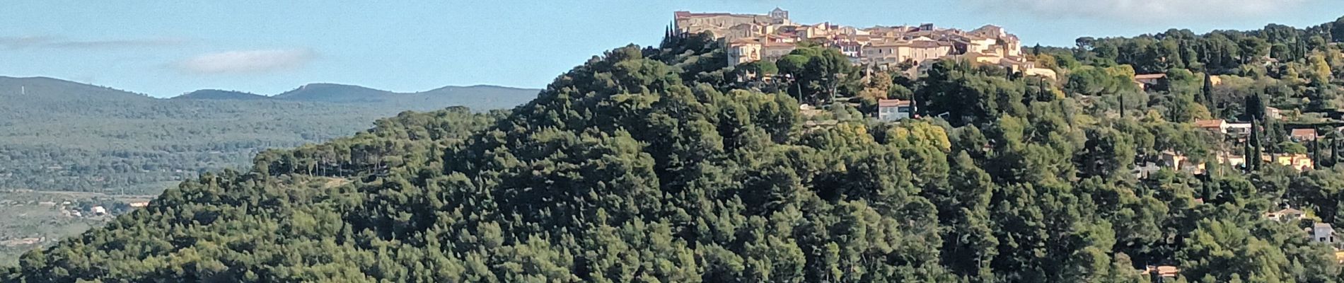
Trail Walking of 7.9 km to be discovered at Provence-Alpes-Côte d'Azur, Var, La Cadière-d'Azur. This trail is proposed by Christiancordin.
Description
Pk en bas du village-table d'orientation-Chapelle Ste Croix-panorama Ste Baume et baie de la Ciotat-monument de la paix.
Photos


Positioning
Country:
France
Region :
Provence-Alpes-Côte d'Azur
Department/Province :
Var
Municipality :
La Cadière-d'Azur
Location:
Unknown
Start:(Dec)
Start:(UTM)
724086 ; 4786364 (31T) N.
Comments