Trail Walking Sainte-Maxime - Chapelle St Donat - Marri Vallat - Le Revest - Col de Grateloup - Photo

Chapelle St Donat - Marri Vallat - Le Revest - Col de Grateloup

 LtZIP
LtZIP

User

© OpenStreetMap contributors
Length
Length
19 km
Max alt
Max alt
373 m
Uphill gradient
Uphill gradient
595 m
Km-Effort
Km-Effort  
27 km
Min alt
Min alt
87 m
Downhill gradient
Downhill gradient
594 m
Boucle
Boucle
Yes
Creation date :
2021-11-07 07:34:52.724
Updated on :
2021-11-07 20:33:19.069

(0 Reviews)

Walking
Walking
4h35
Difficulty : Easy

Scan this QR Code to open this trail in the SityTrail application

FREE GPS app for hiking

Logo SityTrail SityTrail

IGN / Geographical institutes

Download SityTrail from the App Store Download SityTrail from Google Play

Logo SityTrail SityTrail World

The world is yours!

Download SityTrail from the App Store Download SityTrail from Google Play Download SityTrail on Huawei AppGallery

About

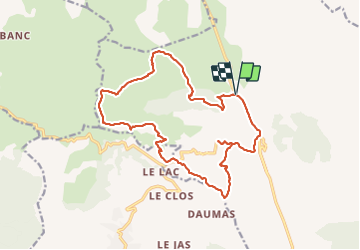
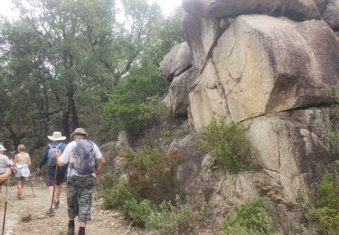
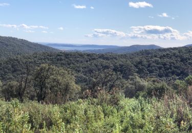
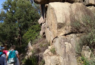
Trail Walking of 19 km to be discovered at Provence-Alpes-Côte d'Azur, Var, Sainte-Maxime. This trail is proposed by LtZIP.

Description

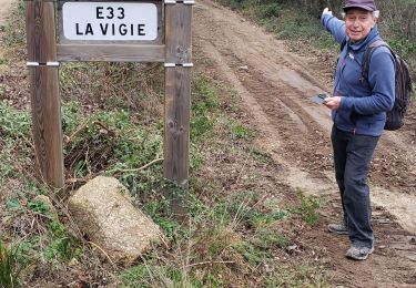
Retour le long de la D25 au lieu de passer par "Les Suis" car forte pluie
IBP
Orange 69

Elevation profile

Photos

Positioning

Country:
France
Region :
Provence-Alpes-Côte d'Azur
Department/Province :
Var
Municipality :
Sainte-Maxime
Location:
Unknown
Start:(UTM)
304646 ; 4806176 (32T) N.

Trails nearby

Trail Walking Sainte-Maxime - Les Suils GR 51 départ de saint donat - Photo
Walking
jean-marie.parachini

Walking

Medium
Sainte-Maxime, Provence-Alpes-Côte d'Azur, Var, France
4.2 km | 6.6 km-effort
1h 41min
Yes
Trail Walking Le Muy - Castel Diaou - Photo
Walking
Sugg

Walking

Easy
Le Muy, Provence-Alpes-Côte d'Azur, Var, France
8.1 km | 11 km-effort
2h 31min
Yes
Trail Walking Le Muy - kjhgf - Photo
Walking
boulinevelyne

Walking

Medium
Le Muy, Provence-Alpes-Côte d'Azur, Var, France
7.3 km | 10.7 km-effort
2h 25min
Yes
Trail Walking Le Muy - Les jujubiers et le Marri Vallat - Photo
Walking
boulinevelyne

Walking

Medium
Le Muy, Provence-Alpes-Côte d'Azur, Var, France
10.9 km | 16.2 km-effort
3h 23min
Yes
Trail Walking Sainte-Maxime - Vers Peigros - Photo
Walking
jean-marie.parachini

Walking

Easy
Sainte-Maxime, Provence-Alpes-Côte d'Azur, Var, France
6.8 km | 9.3 km-effort
2h 43min
Yes
Trail Walking Sainte-Maxime - Le déffend ste maxime - Photo
Walking
jean-marie.parachini

Walking

Very easy
Sainte-Maxime, Provence-Alpes-Côte d'Azur, Var, France
6 km | 8.8 km-effort
2h 43min
No
Trail Walking Sainte-Maxime - Misteriou Valdingarde - Photo
Walking
MERMOZ33

Walking

Very easy
Sainte-Maxime, Provence-Alpes-Côte d'Azur, Var, France
14 km | 19.9 km-effort
6h 19min
Yes
Trail Walking Sainte-Maxime - Ste Maxime - Chapelle St Donnat - Le Revest - Photo
Walking
ETMU5496

Walking

Medium
Sainte-Maxime, Provence-Alpes-Côte d'Azur, Var, France
18.8 km | 28 km-effort
4h 25min
Yes
Trail Walking Le Muy - grand courrent - Photo
Walking
vincente204

Walking

Easy
Le Muy, Provence-Alpes-Côte d'Azur, Var, France
7.5 km | 10.8 km-effort
2h 33min
Yes


Close
My subscriptions