


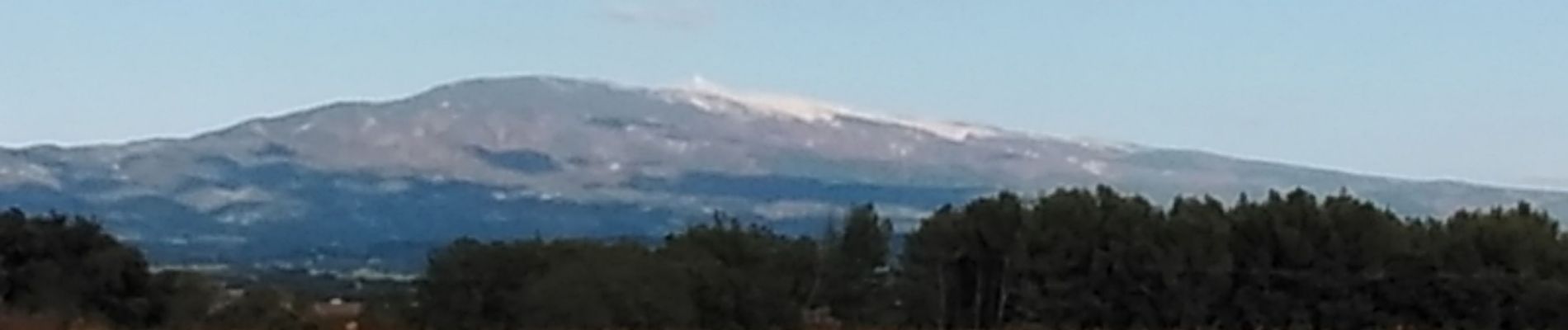
carpentras la lègue et le canal

aupi
User
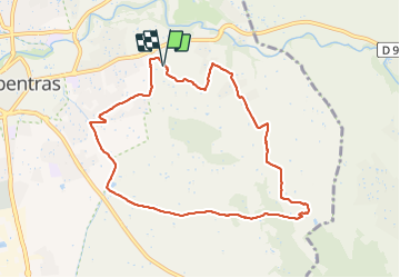

Length
9.2 km

Max alt
200 m

Uphill gradient
153 m
Km-Effort
11.3 km

Min alt
86 m

Downhill gradient
157 m
Boucle
Yes
Creation date :
2021-11-08 13:22:09.812
Updated on :
2021-11-09 03:25:02.56
2h26
Difficulty : Easy

FREE GPS app for hiking
 SityTrail
IGN / Geographical institutes
SityTrail Plus
The world is yours!
About
Trail Walking of 9.2 km to be discovered at Provence-Alpes-Côte d'Azur, Vaucluse, Carpentras. This trail is proposed by aupi.
Photos


Positioning
Country:
France
Region :
Provence-Alpes-Côte d'Azur
Department/Province :
Vaucluse
Municipality :
Carpentras
Location:
Unknown
Start:(Dec)
Start:(UTM)
665979 ; 4880326 (31T) N.
Comments