


pomaret

JMJ42
User
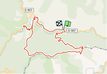

Length
13.1 km

Max alt
846 m

Uphill gradient
601 m
Km-Effort
21 km

Min alt
384 m

Downhill gradient
601 m
Boucle
Yes
Creation date :
2021-11-09 08:23:20.963
Updated on :
2021-11-09 15:20:25.247
4h11
Difficulty : Very difficult

FREE GPS app for hiking
 SityTrail
IGN / Geographical institutes
SityTrail Plus
The world is yours!
About
Trail Walking of 13.1 km to be discovered at Occitania, Gard, Saint-André-de-Valborgne. This trail is proposed by JMJ42.
Positioning
Country:
France
Region :
Occitania
Department/Province :
Gard
Municipality :
Saint-André-de-Valborgne
Location:
Unknown
Start:(Dec)
Start:(UTM)
557143 ; 4887692 (31T) N.
Comments