


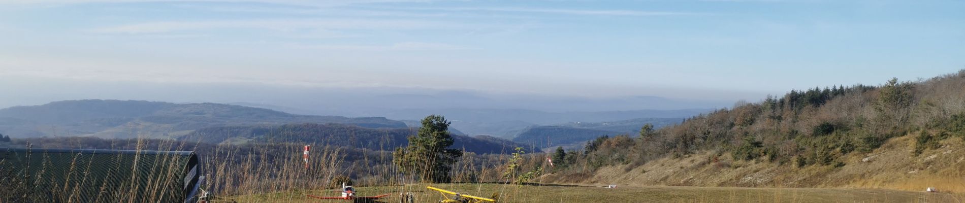
rando corlier altiport

bubufred
User
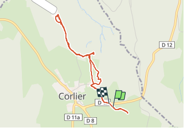

Length
4.3 km

Max alt
850 m

Uphill gradient
110 m
Km-Effort
5.8 km

Min alt
777 m

Downhill gradient
117 m
Boucle
Yes
Creation date :
2021-11-11 12:37:46.271
Updated on :
2021-11-11 14:08:53.185
1h30
Difficulty : Easy

FREE GPS app for hiking
 SityTrail
IGN / Geographical institutes
SityTrail Plus
The world is yours!
About
Trail Walking of 4.3 km to be discovered at Auvergne-Rhône-Alpes, Ain, Corlier. This trail is proposed by bubufred.
Photos

Positioning
Country:
France
Region :
Auvergne-Rhône-Alpes
Department/Province :
Ain
Municipality :
Corlier
Location:
Unknown
Start:(Dec)
Start:(UTM)
693938 ; 5100288 (31T) N.
Comments