


divajeu

jphugon
User
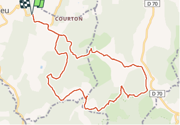

Length
13.3 km

Max alt
463 m

Uphill gradient
478 m
Km-Effort
19.6 km

Min alt
248 m

Downhill gradient
480 m
Boucle
Yes
Creation date :
2021-11-11 08:26:39.546
Updated on :
2021-11-11 14:53:08.966
6h25
Difficulty : Very difficult

FREE GPS app for hiking
 SityTrail
IGN / Geographical institutes
SityTrail Plus
The world is yours!
About
Trail Walking of 13.3 km to be discovered at Auvergne-Rhône-Alpes, Drôme, Divajeu. This trail is proposed by jphugon.
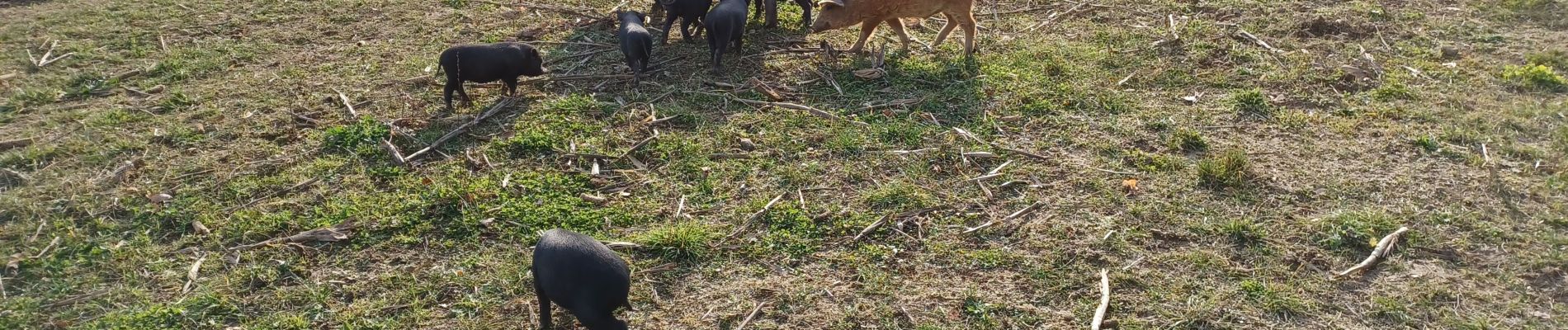
Photos


Positioning
Country:
France
Region :
Auvergne-Rhône-Alpes
Department/Province :
Drôme
Municipality :
Divajeu
Location:
Unknown
Start:(Dec)
Start:(UTM)
659864 ; 4951994 (31T) N.
Comments