Argelliers bis

jeanfcd
User
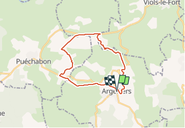

Length
13.6 km

Max alt
297 m

Uphill gradient
217 m
Km-Effort
16.5 km

Min alt
187 m

Downhill gradient
217 m
Boucle
Yes
Creation date :
2021-11-11 12:33:12.671
Updated on :
2021-11-11 16:28:40.515
3h07
Difficulty : Easy

FREE GPS app for hiking
 SityTrail
IGN / Geographical institutes
SityTrail Plus
The world is yours!
About
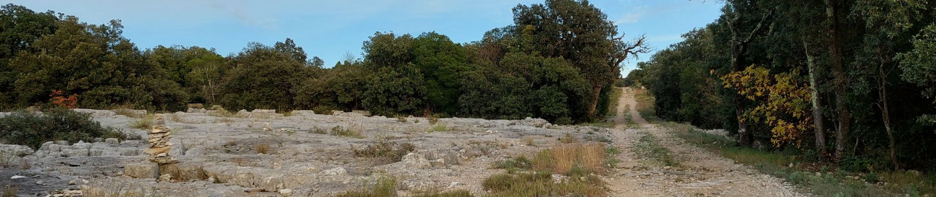
Trail Walking of 13.6 km to be discovered at Occitania, Hérault, Argelliers. This trail is proposed by jeanfcd.
Photos


Positioning
Country:
France
Region :
Occitania
Department/Province :
Hérault
Municipality :
Argelliers
Location:
Unknown
Start:(Dec)
Start:(UTM)
554320 ; 4838671 (31T) N.
Comments