


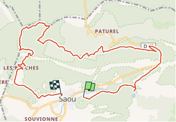
ASPTT Rochecolombe inversé

TOULAUDIN
User

Length
15.2 km

Max alt
874 m

Uphill gradient
649 m
Km-Effort
24 km

Min alt
328 m

Downhill gradient
648 m
Boucle
Yes
Creation date :
2021-11-07 08:20:42.733
Updated on :
2021-11-11 17:56:14.031
5h48
Difficulty : Medium

FREE GPS app for hiking
 SityTrail
IGN / Geographical institutes
SityTrail Plus
The world is yours!
About
Trail Walking of 15.2 km to be discovered at Auvergne-Rhône-Alpes, Drôme, Saou. This trail is proposed by TOULAUDIN.
Description
trace enregistrée
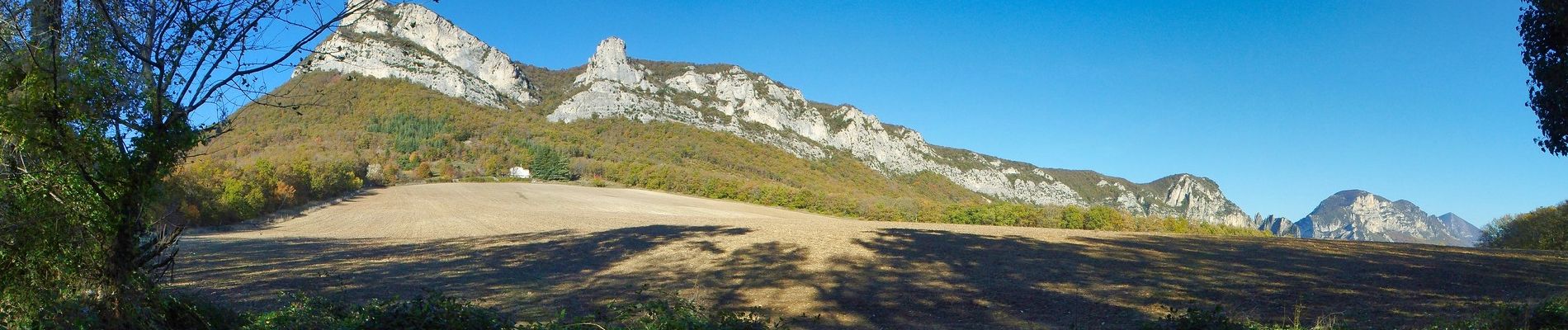
Photos


Positioning
Country:
France
Region :
Auvergne-Rhône-Alpes
Department/Province :
Drôme
Municipality :
Saou
Location:
Unknown
Start:(Dec)
Start:(UTM)
663422 ; 4945757 (31T) N.
Comments