Trail Walking Montfuron - 1Montjustin - Photo
 liocol
liocol

User

© OpenStreetMap contributors
Length
Length
9.1 km
Max alt
Max alt
664 m
Uphill gradient
Uphill gradient
222 m
Km-Effort
Km-Effort  
12 km
Min alt
Min alt
545 m
Downhill gradient
Downhill gradient
219 m
Boucle
Boucle
Yes
Creation date :
2021-11-12 08:18:18.237
Updated on :
2021-12-14 10:31:35.202

(0 Reviews)

Walking
Walking
2h35
Difficulty : Medium

Scan this QR Code to open this trail in the SityTrail application

FREE GPS app for hiking

Logo SityTrail SityTrail

IGN / Geographical institutes

Download SityTrail from the App Store Download SityTrail from Google Play

Logo SityTrail SityTrail World

The world is yours!

Download SityTrail from the App Store Download SityTrail from Google Play Download SityTrail on Huawei AppGallery

About

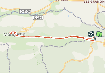
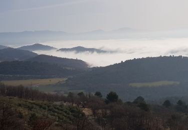
Trail Walking of 9.1 km to be discovered at Provence-Alpes-Côte d'Azur, Alpes-de-Haute-Provence, Montfuron. This trail is proposed by liocol.

Description

Prendre la direction de la Bastide des Jourdans, à 400 m, un petit Parking sur la droite.
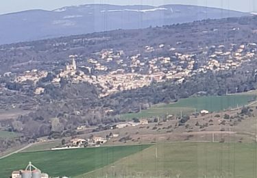
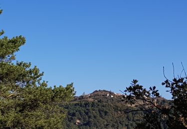
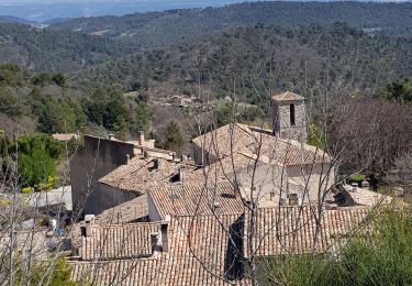
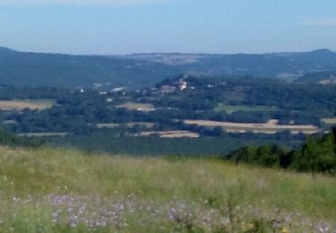
Montjustin est un très beau village, descendez vers le cimetière pour voir la tombe d'un photographe très célèbre, mort en 2004.

Elevation profile

Photos

Positioning

Country:
France
Region :
Provence-Alpes-Côte d'Azur
Department/Province :
Alpes-de-Haute-Provence
Municipality :
Montfuron
Location:
Unknown
Start:(UTM)
715623 ; 4858265 (31T) N.

Trails nearby

Trail Walking Saint-Michel-l'Observatoire - LINCEL Moulin de l Agnelier - Photo
Walking
RobinMicheline

Walking

Easy
(1)
Saint-Michel-l'Observatoire, Provence-Alpes-Côte d'Azur, Alpes-de-Haute-Provence, France
13.6 km | 17.8 km-effort
6h 22min
Yes
Trail Walking Reillanne - 2024-03-01 Tour de Reillanne  - Photo
Walking
GUIDE
Kargil

Walking

Difficult
Reillanne, Provence-Alpes-Côte d'Azur, Alpes-de-Haute-Provence, France
17.9 km | 24 km-effort
5h 30min
Yes
Trail Walking Saint-Martin-les-Eaux - 1Domaine de Bourne - Photo
Walking
liocol

Walking

Medium
Saint-Martin-les-Eaux, Provence-Alpes-Côte d'Azur, Alpes-de-Haute-Provence, France
5.6 km | 8.3 km-effort
2h 2min
Yes
Trail Walking Montfuron - 1Montfuron, Villemus via la Colle et le Moulin. - Photo
Walking
liocol

Walking

Easy
Montfuron, Provence-Alpes-Côte d'Azur, Alpes-de-Haute-Provence, France
7.6 km | 9.9 km-effort
2h 4min
Yes
Trail Walking Montfuron - 1Montfuron, le relais de Villemus - Photo
Walking
liocol

Walking

Medium
Montfuron, Provence-Alpes-Côte d'Azur, Alpes-de-Haute-Provence, France
8 km | 11.2 km-effort
2h 9min
Yes
Trail Walking Montfuron - Montfuron à Villemus, variante.  - Photo
Walking
liocol

Walking

Easy
(2)
Montfuron, Provence-Alpes-Côte d'Azur, Alpes-de-Haute-Provence, France
7.6 km | 9.8 km-effort
2h 3min
Yes
Trail Walking Montfuron - 1Montfuron, via les Granges et le chemin Mériton - Photo
Walking
liocol

Walking

Difficult
Montfuron, Provence-Alpes-Côte d'Azur, Alpes-de-Haute-Provence, France
9.5 km | 13.9 km-effort
2h 36min
Yes
Trail Walking Montfuron - Montfuron, départ P entrée village - Photo
Walking
liocol

Walking

Easy
Montfuron, Provence-Alpes-Côte d'Azur, Alpes-de-Haute-Provence, France
4.7 km | 6.4 km-effort
1h 57min
Yes
Trail Walking Saint-Martin-les-Eaux - De la Ferme de Borne à St Martin - Photo
Walking
liocol

Walking

Easy
Saint-Martin-les-Eaux, Provence-Alpes-Côte d'Azur, Alpes-de-Haute-Provence, France
6.3 km | 8.6 km-effort
1h 49min
Yes


Close
My subscriptions