


Valaurie Aiguebelle 18 km

chancha
User GUIDE
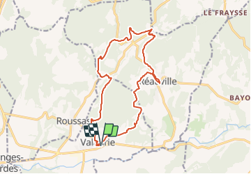

Length
17.6 km

Max alt
272 m

Uphill gradient
426 m
Km-Effort
23 km

Min alt
116 m

Downhill gradient
424 m
Boucle
Yes
Creation date :
2021-11-14 07:53:32.919
Updated on :
2021-11-17 09:59:39.705
6h24
Difficulty : Medium

FREE GPS app for hiking
 SityTrail
IGN / Geographical institutes
SityTrail Plus
The world is yours!
About
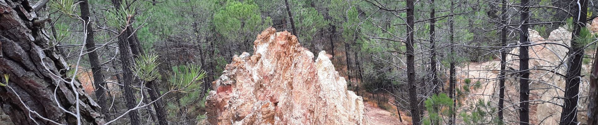
Trail Walking of 17.6 km to be discovered at Auvergne-Rhône-Alpes, Drôme, Valaurie. This trail is proposed by chancha.
Photos


Positioning
Country:
France
Region :
Auvergne-Rhône-Alpes
Department/Province :
Drôme
Municipality :
Valaurie
Location:
Unknown
Start:(Dec)
Start:(UTM)
644549 ; 4920276 (31T) N.
Comments