


étang de Berre

PatriceCocuaud
User

Length
4 km

Max alt
3 m

Uphill gradient
8 m
Km-Effort
4.1 km

Min alt
-3 m

Downhill gradient
9 m
Boucle
Yes
Creation date :
2021-11-15 08:20:35.533
Updated on :
2021-11-15 09:02:42.165
41m
Difficulty : Easy

FREE GPS app for hiking
 SityTrail
IGN / Geographical institutes
SityTrail Plus
The world is yours!
About
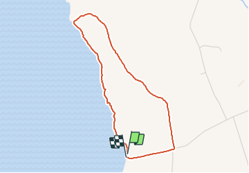
Trail Running of 4 km to be discovered at Provence-Alpes-Côte d'Azur, Bouches-du-Rhône, Berre-l'Étang. This trail is proposed by PatriceCocuaud.
Positioning
Country:
France
Region :
Provence-Alpes-Côte d'Azur
Department/Province :
Bouches-du-Rhône
Municipality :
Berre-l'Étang
Location:
Unknown
Start:(Dec)
Start:(UTM)
671669 ; 4817397 (31T) N.
Comments