


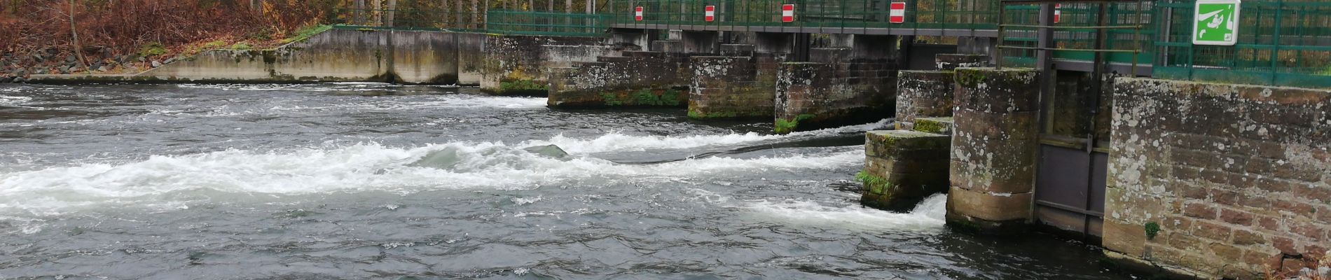
le long de l ill

apa
User
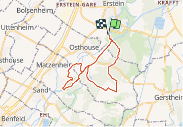

Length
13.8 km

Max alt
161 m

Uphill gradient
83 m
Km-Effort
14.9 km

Min alt
148 m

Downhill gradient
83 m
Boucle
Yes
Creation date :
2021-11-16 08:23:49.525
Updated on :
2021-11-16 12:56:44.588
3h33
Difficulty : Medium

FREE GPS app for hiking
 SityTrail
IGN / Geographical institutes
SityTrail Plus
The world is yours!
About
Trail Walking of 13.8 km to be discovered at Grand Est, Bas-Rhin, Erstein. This trail is proposed by apa.
Description
Rando agréable
Photos


Positioning
Country:
France
Region :
Grand Est
Department/Province :
Bas-Rhin
Municipality :
Erstein
Location:
Unknown
Start:(Dec)
Start:(UTM)
400809 ; 5362537 (32U) N.
Comments