


La fenêtre-Cassis-17-11-21

Christiancordin
User
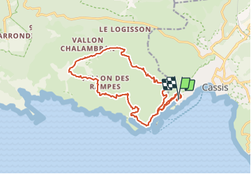

Length
19 km

Max alt
513 m

Uphill gradient
860 m
Km-Effort
30 km

Min alt
4 m

Downhill gradient
858 m
Boucle
Yes
Creation date :
2021-11-17 08:03:01.01
Updated on :
2021-11-17 19:53:42.922
7h03
Difficulty : Difficult

FREE GPS app for hiking
 SityTrail
IGN / Geographical institutes
SityTrail Plus
The world is yours!
About
Trail Walking of 19 km to be discovered at Provence-Alpes-Côte d'Azur, Bouches-du-Rhône, Cassis. This trail is proposed by Christiancordin.
Description
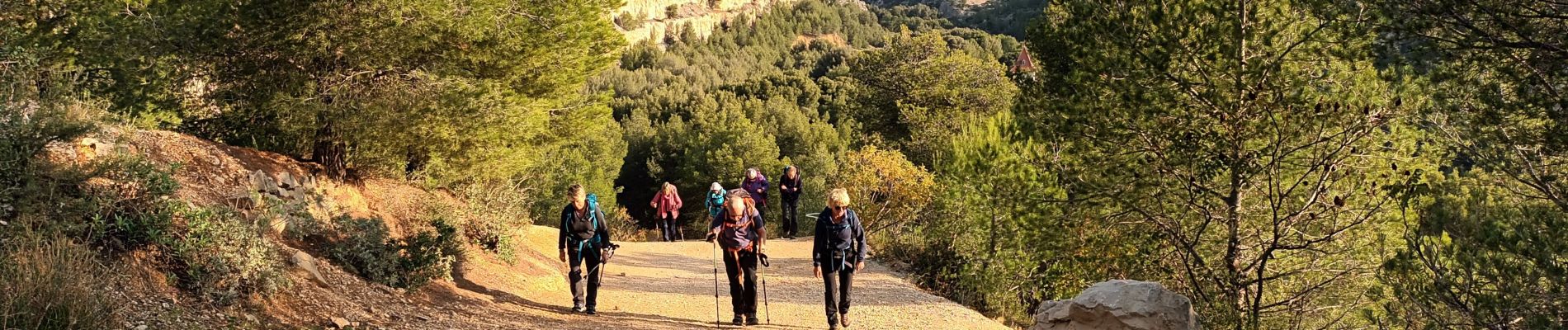
Cassis-Puits de La Fontasse-Auberge de jeunesse de la Fontasse-La Gardiole-vallon de la fenêtre-col de la fenêtre-col de l'Oule-En Vau-port pin-port miou.
Photos


Positioning
Country:
France
Region :
Provence-Alpes-Côte d'Azur
Department/Province :
Bouches-du-Rhône
Municipality :
Cassis
Location:
Unknown
Start:(Dec)
Start:(UTM)
704815 ; 4787154 (31T) N.
Comments