


Cipiere World

jlrayon
User
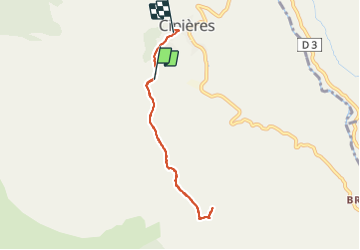

Length
6.5 km

Max alt
991 m

Uphill gradient
208 m
Km-Effort
9.5 km

Min alt
763 m

Downhill gradient
273 m
Boucle
No
Creation date :
2021-11-17 09:56:42.96
Updated on :
2021-11-17 18:06:24.129
5h27
Difficulty : Medium

FREE GPS app for hiking
 SityTrail
IGN / Geographical institutes
SityTrail Plus
The world is yours!
About
Trail Walking of 6.5 km to be discovered at Provence-Alpes-Côte d'Azur, Maritime Alps, Cipières. This trail is proposed by jlrayon.
Positioning
Country:
France
Region :
Provence-Alpes-Côte d'Azur
Department/Province :
Maritime Alps
Municipality :
Cipières
Location:
Unknown
Start:(Dec)
Start:(UTM)
335069 ; 4849075 (32T) N.
Comments