Trail Walking Prads-Haute-Bléone - LA JAVIE , refuge de la Ceriege . S Pierre o n  - Photo

LA JAVIE , refuge de la Ceriege . S Pierre o n

© OpenStreetMap contributors
Length
Length
12.3 km
Max alt
Max alt
1176 m
Uphill gradient
Uphill gradient
615 m
Km-Effort
Km-Effort  
21 km
Min alt
Min alt
843 m
Downhill gradient
Downhill gradient
615 m
Boucle
Boucle
Yes
Creation date :
2021-11-19 07:06:36.4
Updated on :
2021-11-20 16:09:03.814

(0 Reviews)

Walking
Walking
4h41
Difficulty : Medium

Scan this QR Code to open this trail in the SityTrail application

FREE GPS app for hiking

Logo SityTrail SityTrail

IGN / Geographical institutes

Download SityTrail from the App Store Download SityTrail from Google Play

Logo SityTrail SityTrail World

The world is yours!

Download SityTrail from the App Store Download SityTrail from Google Play Download SityTrail on Huawei AppGallery

About

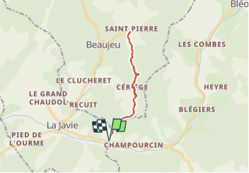
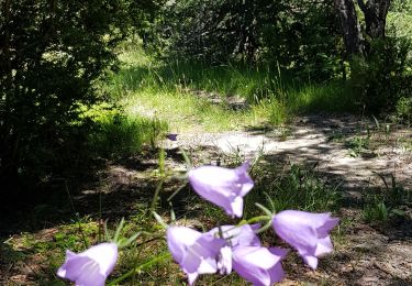
Trail Walking of 12.3 km to be discovered at Provence-Alpes-Côte d'Azur, Alpes-de-Haute-Provence, Prads-Haute-Bléone. This trail is proposed by RobinMicheline.

Description

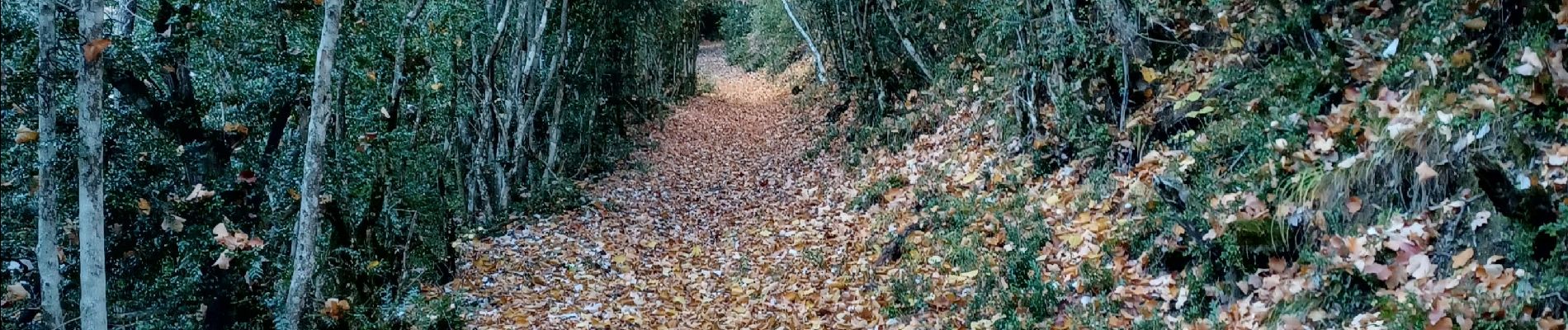
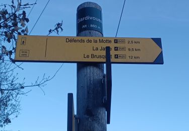
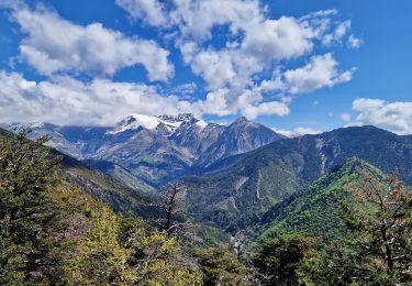
Sentiers sympa,  facile  , bien indiquer , refuge ouvert on peux y dormir et se chauffer

Elevation profile

Photos

Positioning

Country:
France
Region :
Provence-Alpes-Côte d'Azur
Department/Province :
Alpes-de-Haute-Provence
Municipality :
Prads-Haute-Bléone
Location:
Blégiers
Start:(UTM)
290123 ; 4893951 (32T) N.

Trails nearby

Trail Walking Prads-Haute-Bléone - Sentier MARCEL -Boucle 6.4Km) - Photo
Walking
neitag61

Walking

Medium
(1)
Prads-Haute-Bléone, Provence-Alpes-Côte d'Azur, Alpes-de-Haute-Provence, France
6.2 km | 9.6 km-effort
2h 4min
Yes
Trail Walking Draix - DRAIX .REFUGE DE BELON .CRETE DE LA BLACHE .O L  - Photo
Walking
RobinMicheline

Walking

Medium
Draix, Provence-Alpes-Côte d'Azur, Alpes-de-Haute-Provence, France
13.7 km | 22 km-effort
4h 7min
Yes
Trail Walking Draix - 20210506_Draix - Tête de Chabane - Photo
Walking
PapouBertrand

Walking

Difficult
Draix, Provence-Alpes-Côte d'Azur, Alpes-de-Haute-Provence, France
16.6 km | 29 km-effort
6h 40min
Yes
Trail Walking Prads-Haute-Bléone - Prads-Haute-Bléone heyre chavailles 17k 950m - Photo
Walking
Danielba

Walking

Medium
Prads-Haute-Bléone, Provence-Alpes-Côte d'Azur, Alpes-de-Haute-Provence, France
15.5 km | 28 km-effort
7h 14min
Yes
Trail Walking Beaujeu - Sommet Barre des Tremblès (St Pierre) - Photo
Walking
PapouBertrand

Walking

Very difficult
Beaujeu, Provence-Alpes-Côte d'Azur, Alpes-de-Haute-Provence, France
11.4 km | 19.1 km-effort
4h 20min
Yes
Trail Walking Le Brusquet - LE BRUSQUET  .Le tour des Blaches n - Photo
Walking
RobinMicheline

Walking

Difficult
Le Brusquet, Provence-Alpes-Côte d'Azur, Alpes-de-Haute-Provence, France
13.4 km | 20 km-effort
3h 56min
Yes
Trail Walking La Javie - 04 Près de la Javie - Chaudol/Boulard/la Bouisse - Photo
Walking
chris13370

Walking

Easy
(1)
La Javie, Provence-Alpes-Côte d'Azur, Alpes-de-Haute-Provence, France
14.8 km | 23 km-effort
5h 0min
Yes
Trail Walking Prads-Haute-Bléone - Sentier Marcel 2 - Photo
Walking

Walking

Medium
(1)
Prads-Haute-Bléone, Provence-Alpes-Côte d'Azur, Alpes-de-Haute-Provence, France
11.7 km | 22 km-effort
4h 38min
Yes
Trail Walking Beaujeu - barre des remblés - Photo
Walking
gibello

Walking

Medium
Beaujeu, Provence-Alpes-Côte d'Azur, Alpes-de-Haute-Provence, France
11.5 km | 19.2 km-effort
4h 53min
Yes


Close
My subscriptions