


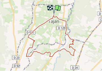
Bois de Gélabonde à Tajan - G4

mitch1952
User

Length
10 km

Max alt
546 m

Uphill gradient
292 m
Km-Effort
13.9 km

Min alt
411 m

Downhill gradient
292 m
Boucle
Yes
Creation date :
2021-11-19 17:23:21.546
Updated on :
2021-11-20 07:45:37.297
3h09
Difficulty : Easy

FREE GPS app for hiking
 SityTrail
IGN / Geographical institutes
SityTrail Plus
The world is yours!
About
Trail On foot of 10 km to be discovered at Occitania, Hautespyrenees, Tajan. This trail is proposed by mitch1952.
Positioning
Country:
France
Region :
Occitania
Department/Province :
Hautespyrenees
Municipality :
Tajan
Location:
Unknown
Start:(Dec)
Start:(UTM)
293616 ; 4785143 (31T) N.
Comments