


2021-11-22 Caunes Corbières

Bernardb44
User

Length
30 km

Max alt
356 m

Uphill gradient
418 m
Km-Effort
36 km

Min alt
94 m

Downhill gradient
467 m
Boucle
No
Creation date :
2021-11-22 13:55:41.958
Updated on :
2021-11-22 17:16:53.923
3h20
Difficulty : Easy

FREE GPS app for hiking
 SityTrail
IGN / Geographical institutes
SityTrail Plus
The world is yours!
About
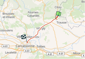
Trail Walking of 30 km to be discovered at Occitania, Aude, Caunes-Minervois. This trail is proposed by Bernardb44.
Positioning
Country:
France
Region :
Occitania
Department/Province :
Aude
Municipality :
Caunes-Minervois
Location:
Unknown
Start:(Dec)
Start:(UTM)
461515 ; 4797187 (31T) N.
Comments