


chambaran

brigitBB26
User
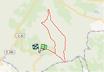

Length
8.2 km

Max alt
659 m

Uphill gradient
115 m
Km-Effort
9.7 km

Min alt
605 m

Downhill gradient
114 m
Boucle
Yes
Creation date :
2021-11-22 12:17:07.652
Updated on :
2021-11-22 18:26:38.818
2h40
Difficulty : Medium

FREE GPS app for hiking
 SityTrail
IGN / Geographical institutes
SityTrail Plus
The world is yours!
About
Trail Walking of 8.2 km to be discovered at Auvergne-Rhône-Alpes, Isère, Roybon. This trail is proposed by brigitBB26.
Positioning
Country:
France
Region :
Auvergne-Rhône-Alpes
Department/Province :
Isère
Municipality :
Roybon
Location:
Unknown
Start:(Dec)
Start:(UTM)
676786 ; 5009760 (31T) N.
Comments