


z le coulet redon 23-1121

cb8310
User
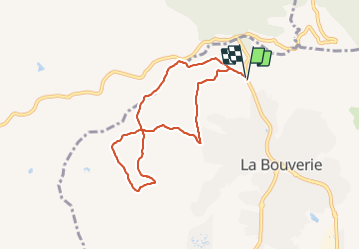

Length
7.6 km

Max alt
128 m

Uphill gradient
128 m
Km-Effort
9.3 km

Min alt
42 m

Downhill gradient
127 m
Boucle
Yes
Creation date :
2021-11-23 13:05:51.164
Updated on :
2021-11-25 13:11:06.795
2h40
Difficulty : Medium

FREE GPS app for hiking
 SityTrail
IGN / Geographical institutes
SityTrail Plus
The world is yours!
About
Trail Walking of 7.6 km to be discovered at Provence-Alpes-Côte d'Azur, Var, Roquebrune-sur-Argens. This trail is proposed by cb8310.
Description
rando très zen à part à l'arrivée un raidillon très pentu en descente sur un sentier ne figurant pas sur la carte ign
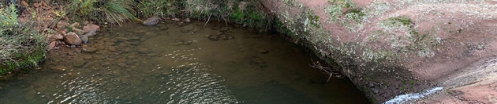
Photos


Positioning
Country:
France
Region :
Provence-Alpes-Côte d'Azur
Department/Province :
Var
Municipality :
Roquebrune-sur-Argens
Location:
Unknown
Start:(Dec)
Start:(UTM)
309117 ; 4820322 (32T) N.
Comments