


andorre_Juclar_20100823

Nordic33
User GUIDE
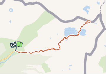

Length
11.9 km

Max alt
2452 m

Uphill gradient
677 m
Km-Effort
21 km

Min alt
1833 m

Downhill gradient
681 m
Boucle
Yes
Creation date :
2021-11-24 14:41:21.799
Updated on :
2022-02-20 17:39:52.024
4h45
Difficulty : Difficult

FREE GPS app for hiking
 SityTrail
IGN / Geographical institutes
SityTrail Plus
The world is yours!
About
Trail Walking of 11.9 km to be discovered at Andorra. This trail is proposed by Nordic33.
Description
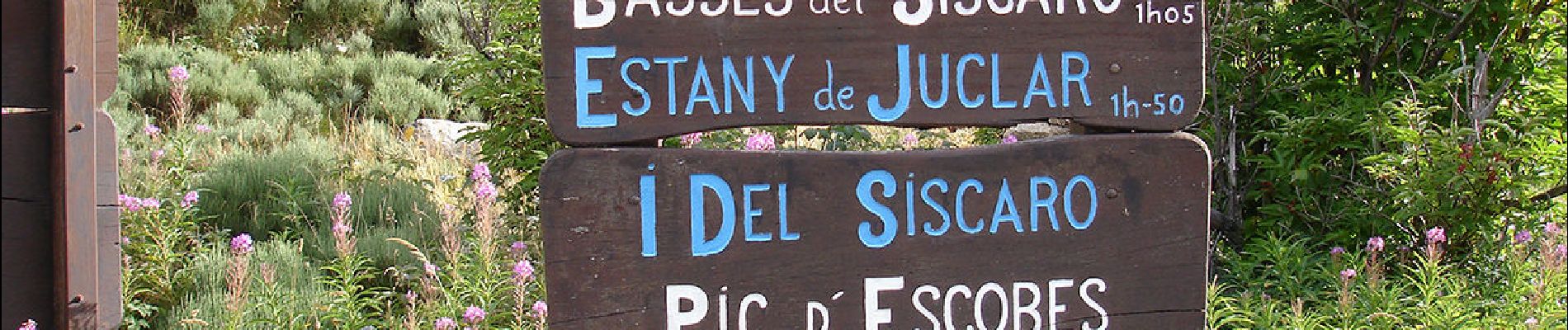
Tracé enregistré le 23 aout 2010
Photos


Positioning
Country:
Andorra
Region :
Unknown
Department/Province :
Unknown
Municipality :
Unknown
Location:
Unknown
Start:(Dec)
Start:(UTM)
392252 ; 4717475 (31T) N.
Comments