


Rance-Forêt domaniale -Etogne-Renlies 6,7km 24112021

alain.guillaume
User
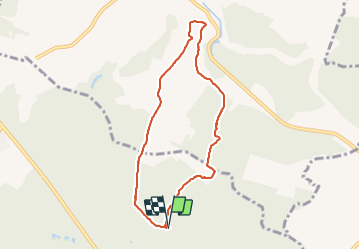

Length
6.7 km

Max alt
273 m

Uphill gradient
88 m
Km-Effort
7.8 km

Min alt
209 m

Downhill gradient
88 m
Boucle
Yes
Creation date :
2021-11-24 13:19:36.277
Updated on :
2025-04-02 09:17:09.972
1h46
Difficulty : Medium

FREE GPS app for hiking
 SityTrail
IGN / Geographical institutes
SityTrail Plus
The world is yours!
About
Trail Walking of 6.7 km to be discovered at Wallonia, Hainaut, Sivry-Rance. This trail is proposed by alain.guillaume.
Positioning
Country:
Belgium
Region :
Wallonia
Department/Province :
Hainaut
Municipality :
Sivry-Rance
Location:
Unknown
Start:(Dec)
Start:(UTM)
590287 ; 5557169 (31U) N.
Comments
ok