


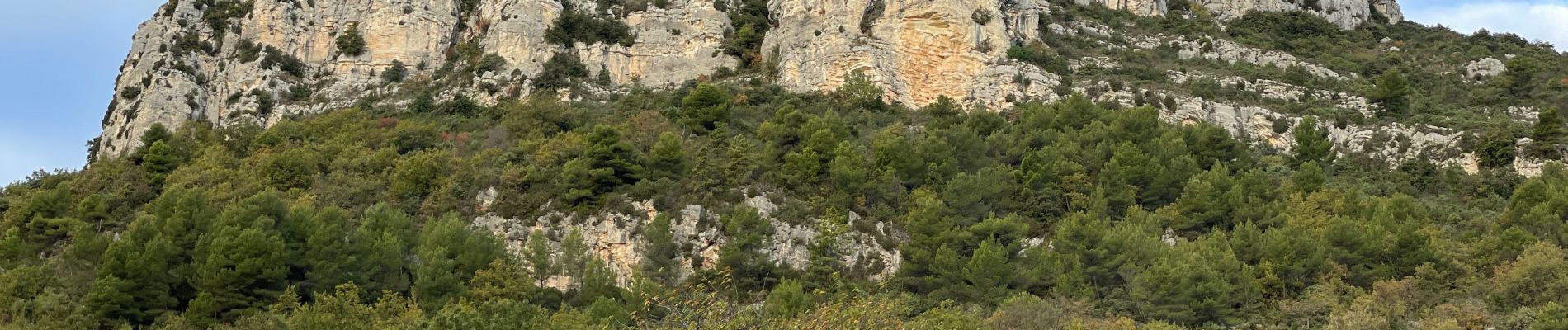
Baous de St Jeannet et de la Gaude

ETMU5496
User
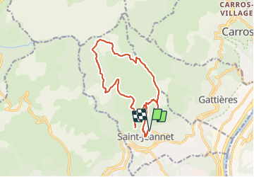

Length
17.6 km

Max alt
872 m

Uphill gradient
796 m
Km-Effort
28 km

Min alt
415 m

Downhill gradient
795 m
Boucle
Yes
Creation date :
2021-11-24 07:48:13.0
Updated on :
2021-11-25 15:47:02.04
4h41
Difficulty : Medium

FREE GPS app for hiking
 SityTrail
IGN / Geographical institutes
SityTrail Plus
The world is yours!
About
Trail Walking of 17.6 km to be discovered at Provence-Alpes-Côte d'Azur, Maritime Alps, Saint-Jeannet. This trail is proposed by ETMU5496.
Photos


Positioning
Country:
France
Region :
Provence-Alpes-Côte d'Azur
Department/Province :
Maritime Alps
Municipality :
Saint-Jeannet
Location:
Unknown
Start:(Dec)
Start:(UTM)
350627 ; 4845723 (32T) N.
Comments