


BALADE NOCTURNE SALEVE 👍

leclaude74
User
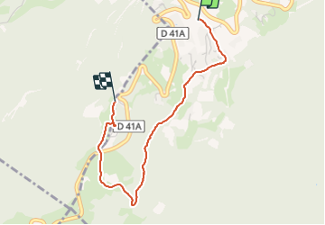

Length
3 km

Max alt
1250 m

Uphill gradient
169 m
Km-Effort
4.8 km

Min alt
1081 m

Downhill gradient
37 m
Boucle
No
Creation date :
2021-11-24 17:45:00.381
Updated on :
2021-11-24 18:27:11.845
41m
Difficulty : Very easy

FREE GPS app for hiking
 SityTrail
IGN / Geographical institutes
SityTrail Plus
The world is yours!
About
Trail Nordic walking of 3 km to be discovered at Auvergne-Rhône-Alpes, Upper Savoy, Monnetier-Mornex. This trail is proposed by leclaude74.
Positioning
Country:
France
Region :
Auvergne-Rhône-Alpes
Department/Province :
Upper Savoy
Municipality :
Monnetier-Mornex
Location:
Monnetier-Mornex
Start:(Dec)
Start:(UTM)
283491 ; 5114835 (32T) N.
Comments