


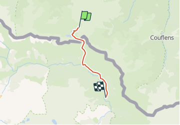
Fornet-Estagnous

ARVIEU
User

Length
11 km

Max alt
2523 m

Uphill gradient
1075 m
Km-Effort
28 km

Min alt
1400 m

Downhill gradient
1889 m
Boucle
No
Creation date :
2021-11-29 08:32:43.938
Updated on :
2021-11-29 08:37:03.747
6h20
Difficulty : Difficult

FREE GPS app for hiking
 SityTrail
IGN / Geographical institutes
SityTrail Plus
The world is yours!
About
Trail Walking of 11 km to be discovered at Occitania, Ariège, Bordes-Uchentein. This trail is proposed by ARVIEU.
Positioning
Country:
France
Region :
Occitania
Department/Province :
Ariège
Municipality :
Bordes-Uchentein
Location:
Les Bordes-sur-Lez
Start:(Dec)
Start:(UTM)
342358 ; 4740086 (31T) N.
Comments