


Col de la Core - Estagnous

ARVIEU
User
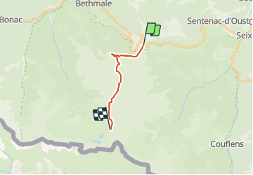

Length
12.3 km

Max alt
2463 m

Uphill gradient
1493 m
Km-Effort
29 km

Min alt
1390 m

Downhill gradient
635 m
Boucle
No
Creation date :
2021-11-29 20:14:22.03
Updated on :
2021-11-29 20:16:19.987
6h39
Difficulty : Difficult

FREE GPS app for hiking
 SityTrail
IGN / Geographical institutes
SityTrail Plus
The world is yours!
About
Trail Walking of 12.3 km to be discovered at Occitania, Ariège, Bethmale. This trail is proposed by ARVIEU.
Positioning
Country:
France
Region :
Occitania
Department/Province :
Ariège
Municipality :
Bethmale
Location:
Unknown
Start:(Dec)
Start:(UTM)
345184 ; 4746868 (31T) N.
Comments