


Coux

ajd26
User
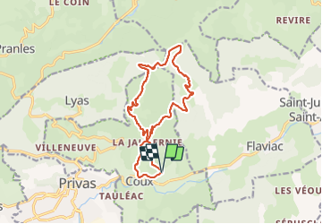

Length
15.9 km

Max alt
832 m

Uphill gradient
734 m
Km-Effort
26 km

Min alt
209 m

Downhill gradient
735 m
Boucle
Yes
Creation date :
2021-11-30 08:11:00.0
Updated on :
2021-12-02 09:01:25.152
4h40
Difficulty : Easy

FREE GPS app for hiking
 SityTrail
IGN / Geographical institutes
SityTrail Plus
The world is yours!
About
Trail Walking of 15.9 km to be discovered at Auvergne-Rhône-Alpes, Ardèche, Coux. This trail is proposed by ajd26.
Description
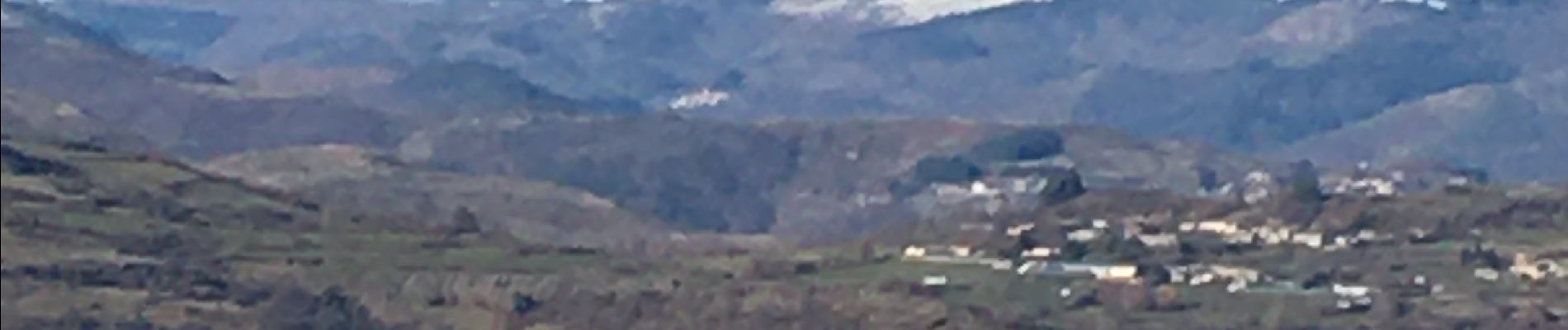
départ de Coux, Serre de l'Eglise et retour par les grottes de la Jaubernie
beaux Panoramas sur le Vercors et le Mézenc
belle randonnée automnale
Photos


Positioning
Country:
France
Region :
Auvergne-Rhône-Alpes
Department/Province :
Ardèche
Municipality :
Coux
Location:
Unknown
Start:(Dec)
Start:(UTM)
629160 ; 4955170 (31T) N.
Comments