


rando du 3 décembre 2021

gillou1947
User
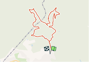

Length
11.9 km

Max alt
195 m

Uphill gradient
307 m
Km-Effort
16 km

Min alt
70 m

Downhill gradient
307 m
Boucle
Yes
Creation date :
2021-12-03 07:53:39.06
Updated on :
2021-12-03 11:00:23.832
3h06
Difficulty : Difficult

FREE GPS app for hiking
 SityTrail
IGN / Geographical institutes
SityTrail Plus
The world is yours!
About
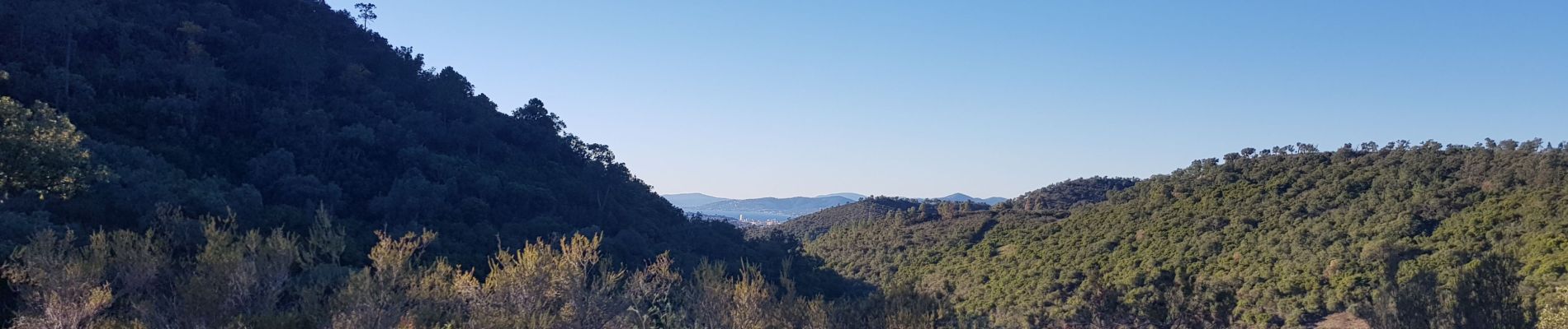
Trail Walking of 11.9 km to be discovered at Provence-Alpes-Côte d'Azur, Var, Saint-Raphaël. This trail is proposed by gillou1947.
Photos

Positioning
Country:
France
Region :
Provence-Alpes-Côte d'Azur
Department/Province :
Var
Municipality :
Saint-Raphaël
Location:
Unknown
Start:(Dec)
Start:(UTM)
323563 ; 4814223 (32T) N.
Comments