


Villers-devant-Orval/passage en France

geoffrayLayeux
User
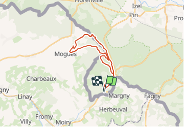

Length
22 km

Max alt
351 m

Uphill gradient
419 m
Km-Effort
27 km

Min alt
188 m

Downhill gradient
419 m
Boucle
Yes
Creation date :
2021-12-04 12:03:49.218
Updated on :
2021-12-04 12:04:37.886
6h10
Difficulty : Very difficult

FREE GPS app for hiking
 SityTrail
IGN / Geographical institutes
SityTrail Plus
The world is yours!
About
Trail Walking of 22 km to be discovered at Wallonia, Luxembourg, Florenville. This trail is proposed by geoffrayLayeux.
Positioning
Country:
Belgium
Region :
Wallonia
Department/Province :
Luxembourg
Municipality :
Florenville
Location:
Unknown
Start:(Dec)
Start:(UTM)
668360 ; 5498790 (31U) N.
Comments