


Longfaye/Hautes Fagnes

geoffrayLayeux
User
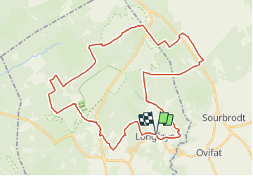

Length
22 km

Max alt
699 m

Uphill gradient
385 m
Km-Effort
27 km

Min alt
502 m

Downhill gradient
388 m
Boucle
Yes
Creation date :
2021-12-05 12:56:56.734
Updated on :
2021-12-05 12:57:35.05
6h05
Difficulty : Very difficult

FREE GPS app for hiking
 SityTrail
IGN / Geographical institutes
SityTrail Plus
The world is yours!
About
Trail Walking of 22 km to be discovered at Wallonia, Liège, Malmedy. This trail is proposed by geoffrayLayeux.
Positioning
Country:
Belgium
Region :
Wallonia
Department/Province :
Liège
Municipality :
Malmedy
Location:
Unknown
Start:(Dec)
Start:(UTM)
292912 ; 5595168 (32U) N.
Comments