


Tourtousse

ajd26
User

Length
19 km

Max alt
505 m

Uphill gradient
643 m
Km-Effort
28 km

Min alt
138 m

Downhill gradient
643 m
Boucle
Yes
Creation date :
2021-12-09 08:33:52.0
Updated on :
2021-12-20 14:26:51.349
4h53
Difficulty : Easy

FREE GPS app for hiking
 SityTrail
IGN / Geographical institutes
SityTrail Plus
The world is yours!
About
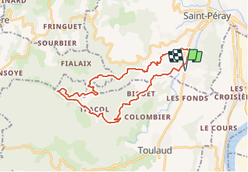
Trail Walking of 19 km to be discovered at Auvergne-Rhône-Alpes, Ardèche, Saint-Péray. This trail is proposed by ajd26.
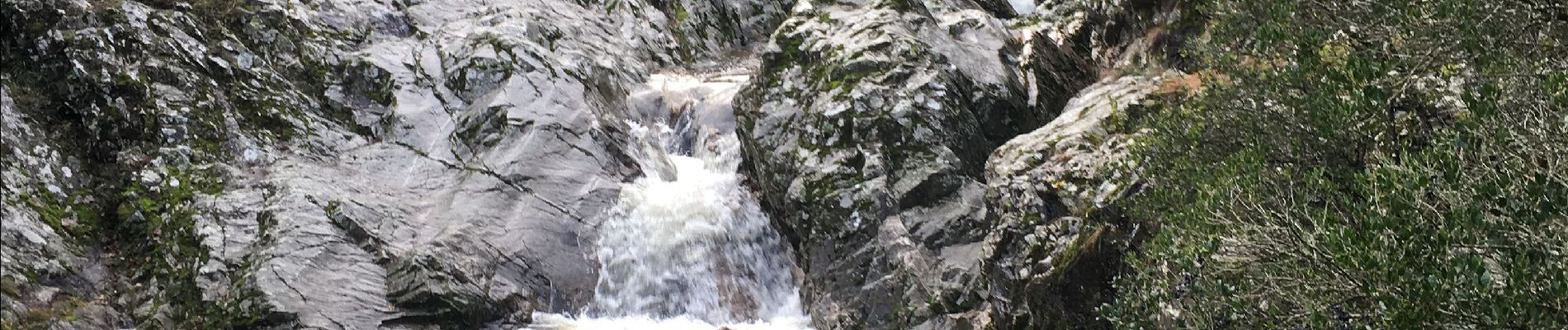
Photos

Positioning
Country:
France
Region :
Auvergne-Rhône-Alpes
Department/Province :
Ardèche
Municipality :
Saint-Péray
Location:
Unknown
Start:(Dec)
Start:(UTM)
644582 ; 4976335 (31T) N.
Comments