


contreforts-de-la-for-t-de-villefermoy

Les 1000 pattes
Club randonnées SERVON

Length
23 km

Max alt
132 m

Uphill gradient
236 m
Km-Effort
26 km

Min alt
89 m

Downhill gradient
235 m
Boucle
Yes
Creation date :
2021-12-11 13:09:36.918
Updated on :
2023-06-02 09:23:16.135
6h00
Difficulty : Difficult

FREE GPS app for hiking
 SityTrail
IGN / Geographical institutes
SityTrail Plus
The world is yours!
About
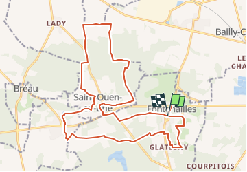
Trail Walking of 23 km to be discovered at Ile-de-France, Seine-et-Marne, Fontenailles. This trail is proposed by Les 1000 pattes.
Description
Parking Rue de l'Eglise à Fontenailles
Trajet Servon-->Fontenailles (43km: 32mn)
Positioning
Country:
France
Region :
Ile-de-France
Department/Province :
Seine-et-Marne
Municipality :
Fontenailles
Location:
Unknown
Start:(Dec)
Start:(UTM)
496498 ; 5377762 (31U) N.
Comments