


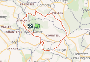
Saint-Omer boucle

geoffrayLayeux
User

Length
16.5 km

Max alt
301 m

Uphill gradient
404 m
Km-Effort
22 km

Min alt
97 m

Downhill gradient
404 m
Boucle
Yes
Creation date :
2021-12-12 14:56:43.155
Updated on :
2021-12-12 14:57:47.315
4h58
Difficulty : Very difficult

FREE GPS app for hiking
 SityTrail
IGN / Geographical institutes
SityTrail Plus
The world is yours!
About
Trail Walking of 16.5 km to be discovered at Normandy, Calvados, Saint-Omer. This trail is proposed by geoffrayLayeux.
Positioning
Country:
France
Region :
Normandy
Department/Province :
Calvados
Municipality :
Saint-Omer
Location:
Unknown
Start:(Dec)
Start:(UTM)
686561 ; 5422330 (30U) N.
Comments