


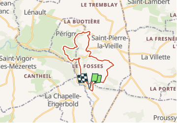
Pontécoulant/le Cresme

geoffrayLayeux
User

Length
11.6 km

Max alt
245 m

Uphill gradient
337 m
Km-Effort
16.1 km

Min alt
127 m

Downhill gradient
340 m
Boucle
Yes
Creation date :
2021-12-12 15:19:19.194
Updated on :
2021-12-12 15:19:55.767
3h39
Difficulty : Difficult

FREE GPS app for hiking
 SityTrail
IGN / Geographical institutes
SityTrail Plus
The world is yours!
About
Trail Walking of 11.6 km to be discovered at Normandy, Calvados, Pontécoulant. This trail is proposed by geoffrayLayeux.
Positioning
Country:
France
Region :
Normandy
Department/Province :
Calvados
Municipality :
Pontécoulant
Location:
Unknown
Start:(Dec)
Start:(UTM)
676661 ; 5418798 (30U) N.
Comments