


Tour des Glovettes

GOHIER
User
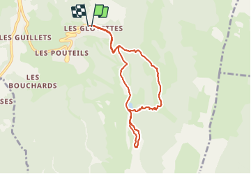

Length
8.5 km

Max alt
1647 m

Uphill gradient
439 m
Km-Effort
14.3 km

Min alt
1238 m

Downhill gradient
443 m
Boucle
Yes
Creation date :
2021-12-12 11:29:35.0
Updated on :
2021-12-12 16:15:54.712
4h44
Difficulty : Unknown

FREE GPS app for hiking
 SityTrail
IGN / Geographical institutes
SityTrail Plus
The world is yours!
About
Trail Touring skiing of 8.5 km to be discovered at Auvergne-Rhône-Alpes, Isère, Villard-de-Lans. This trail is proposed by GOHIER.
Description
Forêt très très enneigée et itinéraire improvisé !
Positioning
Country:
France
Region :
Auvergne-Rhône-Alpes
Department/Province :
Isère
Municipality :
Villard-de-Lans
Location:
Unknown
Start:(Dec)
Start:(UTM)
701834 ; 4991936 (31T) N.
Comments