


grand tour touet la miraillere

aldaus
User
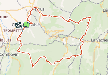

Length
27 km

Max alt
1132 m

Uphill gradient
1121 m
Km-Effort
42 km

Min alt
375 m

Downhill gradient
1099 m
Boucle
Yes
Creation date :
2021-12-15 08:32:09.785
Updated on :
2021-12-15 16:16:24.457
6h54
Difficulty : Medium

FREE GPS app for hiking
 SityTrail
IGN / Geographical institutes
SityTrail Plus
The world is yours!
About
Trail Walking of 27 km to be discovered at Auvergne-Rhône-Alpes, Drôme, Châteaudouble. This trail is proposed by aldaus.
Positioning
Country:
France
Region :
Auvergne-Rhône-Alpes
Department/Province :
Drôme
Municipality :
Châteaudouble
Location:
Unknown
Start:(Dec)
Start:(UTM)
665195 ; 4973317 (31T) N.
Comments