


Creissels in live

CASSISFRAMBOISE
User
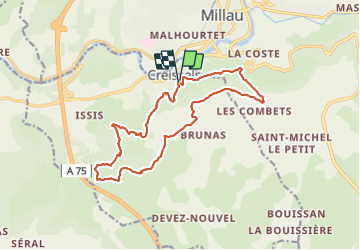

Length
16.9 km

Max alt
798 m

Uphill gradient
644 m
Km-Effort
25 km

Min alt
396 m

Downhill gradient
642 m
Boucle
Yes
Creation date :
2021-12-16 08:35:31.17
Updated on :
2021-12-16 13:50:05.843
4h14
Difficulty : Medium

FREE GPS app for hiking
 SityTrail
IGN / Geographical institutes
SityTrail Plus
The world is yours!
About
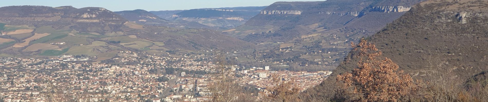
Trail Walking of 16.9 km to be discovered at Occitania, Aveyron, Creissels. This trail is proposed by CASSISFRAMBOISE.
Photos


Positioning
Country:
France
Region :
Occitania
Department/Province :
Aveyron
Municipality :
Creissels
Location:
Unknown
Start:(Dec)
Start:(UTM)
505048 ; 4881188 (31T) N.
Comments