


Eaunes titebalade fait

pidjam
User
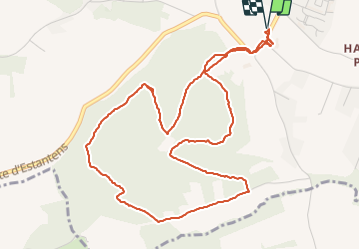

Length
6.5 km

Max alt
293 m

Uphill gradient
174 m
Km-Effort
8.9 km

Min alt
203 m

Downhill gradient
175 m
Boucle
Yes
Creation date :
2021-12-16 13:00:29.387
Updated on :
2021-12-16 14:47:14.715
1h46
Difficulty : Easy

FREE GPS app for hiking
 SityTrail
IGN / Geographical institutes
SityTrail Plus
The world is yours!
About
Trail Walking of 6.5 km to be discovered at Occitania, Haute-Garonne, Eaunes. This trail is proposed by pidjam.
Positioning
Country:
France
Region :
Occitania
Department/Province :
Haute-Garonne
Municipality :
Eaunes
Location:
Unknown
Start:(Dec)
Start:(UTM)
366659 ; 4808760 (31T) N.
Comments