


Liard saint Robert

sameja
User
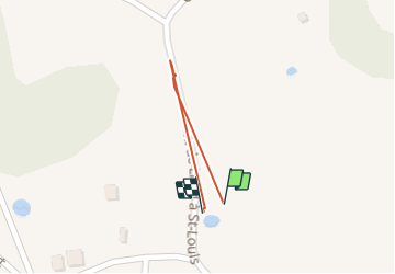

Length
326 m

Max alt
37 m

Uphill gradient
4 m
Km-Effort
379 m

Min alt
28 m

Downhill gradient
4 m
Boucle
Yes
Creation date :
2021-12-18 10:07:34.0
Updated on :
2021-12-18 11:07:07.898
1m
Difficulty : Medium

FREE GPS app for hiking
 SityTrail
IGN / Geographical institutes
SityTrail Plus
The world is yours!
About
Trail Walking of 326 m to be discovered at Guadeloupe, Unknown, Sainte-Anne. This trail is proposed by sameja.
Description
Saint Anne
Photos

Positioning
Country:
France
Region :
Guadeloupe
Department/Province :
Unknown
Municipality :
Sainte-Anne
Location:
Unknown
Start:(Dec)
Start:(UTM)
672428 ; 1799148 (20Q) N.
Comments