


Sentier Imoucha

Lobin
User
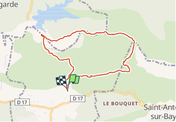

Length
9.3 km

Max alt
674 m

Uphill gradient
458 m
Km-Effort
15.4 km

Min alt
257 m

Downhill gradient
459 m
Boucle
Yes
Creation date :
2021-12-19 13:08:28.0
Updated on :
2021-12-19 16:05:49.641
2h40
Difficulty : Difficult

FREE GPS app for hiking
 SityTrail
IGN / Geographical institutes
SityTrail Plus
The world is yours!
About
Trail Walking of 9.3 km to be discovered at Provence-Alpes-Côte d'Azur, Bouches-du-Rhône, Beaurecueil. This trail is proposed by Lobin.
Description
A tester dans l’autre sens
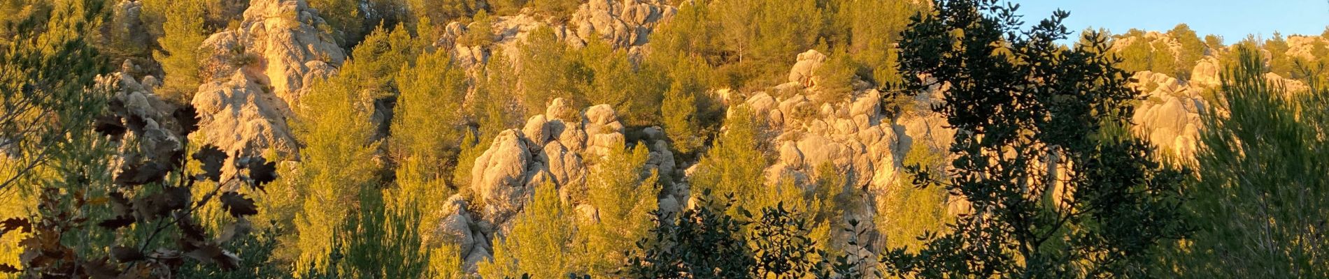
Photos

Positioning
Country:
France
Region :
Provence-Alpes-Côte d'Azur
Department/Province :
Bouches-du-Rhône
Municipality :
Beaurecueil
Location:
Unknown
Start:(Dec)
Start:(UTM)
705862 ; 4822185 (31T) N.
Comments