


sauveclar

vincente204
User
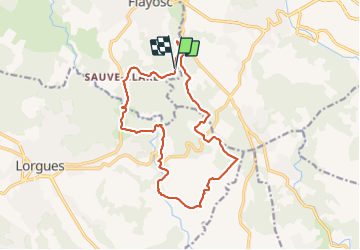

Length
16.8 km

Max alt
271 m

Uphill gradient
366 m
Km-Effort
22 km

Min alt
120 m

Downhill gradient
370 m
Boucle
Yes
Creation date :
2021-12-21 07:51:25.332
Updated on :
2021-12-21 16:00:49.743
5h58
Difficulty : Medium

FREE GPS app for hiking
 SityTrail
IGN / Geographical institutes
SityTrail Plus
The world is yours!
About
Trail Walking of 16.8 km to be discovered at Provence-Alpes-Côte d'Azur, Var, Flayosc. This trail is proposed by vincente204.
Description
facile
Positioning
Country:
France
Region :
Provence-Alpes-Côte d'Azur
Department/Province :
Var
Municipality :
Flayosc
Location:
Unknown
Start:(Dec)
Start:(UTM)
290400 ; 4821506 (32T) N.
Comments