


Salbert

Danielj
User

Length
18.2 km

Max alt
641 m

Uphill gradient
482 m
Km-Effort
25 km

Min alt
329 m

Downhill gradient
505 m
Boucle
No
Creation date :
2021-12-21 12:58:36.0
Updated on :
2021-12-21 16:11:52.854
3h12
Difficulty : Very difficult

FREE GPS app for hiking
 SityTrail
IGN / Geographical institutes
SityTrail Plus
The world is yours!
About
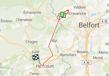
Trail Walking of 18.2 km to be discovered at Bourgogne-Franche-Comté, Haute-Saône, Châlonvillars. This trail is proposed by Danielj.
Positioning
Country:
France
Region :
Bourgogne-Franche-Comté
Department/Province :
Haute-Saône
Municipality :
Châlonvillars
Location:
Unknown
Start:(Dec)
Start:(UTM)
334376 ; 5278972 (32T) N.
Comments