


Blavet

Renefrt
User
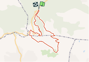

Length
10.3 km

Max alt
270 m

Uphill gradient
343 m
Km-Effort
14.9 km

Min alt
74 m

Downhill gradient
343 m
Boucle
Yes
Creation date :
2021-12-23 08:10:02.608
Updated on :
2021-12-23 14:07:04.624
5h55
Difficulty : Medium

FREE GPS app for hiking
 SityTrail
IGN / Geographical institutes
SityTrail Plus
The world is yours!
About
Trail Walking of 10.3 km to be discovered at Provence-Alpes-Côte d'Azur, Var, Bagnols-en-Forêt. This trail is proposed by Renefrt.
Photos


Positioning
Country:
France
Region :
Provence-Alpes-Côte d'Azur
Department/Province :
Var
Municipality :
Bagnols-en-Forêt
Location:
Unknown
Start:(Dec)
Start:(UTM)
310491 ; 4822178 (32T) N.
Comments